![]() Main
Main
![]()
![]() Latest
Latest
![]()
![]() About
About
![]()
![]() Photos
Photos
![]()
![]() Usage
Usage
![]()
![]() Older
Older
![]()
![]() 2000
2000
![]()
![]() 2001
2001
![]()
![]() Cambridge
Cambridge
![]()
![]() Florida
Florida
![]()
![]() Formby
Formby
![]()
![]() Jodrell
Jodrell
![]()
![]() Wales
Wales
![]()
![]() Rufford
Rufford
![]()
![]() Scotland
Scotland
![]()
![]() York
York
![]()
![]() Yorkshire
Yorkshire
![]()
![]() 2002
2002
![]()
![]() 2003
2003
![]()
![]() 2004
2004
![]()
![]() 2005
2005
![]()
![]() 2006
2006
![]()
![]() Other
Other
![]()
![]()
![]() Abstract
Abstract
![]()
![]() Water
Water
![]()
![]() Sunsets
Sunsets
![]()
![]() Clouds
Clouds
![]()
![]() Surfaces
Surfaces
![]()
![]() Macro
Macro
![]()
![]() WebCam
WebCam
![]()
![]() Words
Words
![]()
![]() Graphics
Graphics
![]()
![]() RISC OS
RISC OS
![]()
![]() Music
Music
![]()
![]() Links
Links
![]()
![]() Credits
Credits
Photos
2001
Scotland
Note that this is pretty much lifted straight out of the diary entry for August 19th 2001.
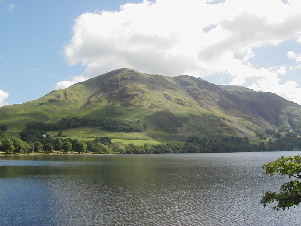
| Buttermere, Lake District (137Kb) Ok, so it's not Scotland, but it was on our way there, so it counts. |
| Skyline, Blackness (near Edinburgh) (133Kb) Quite apart from Blackness being a really cool name for a village, this was a rather nice scene. There's a castle nearby which was our intended destination, but turned out to be closed. |
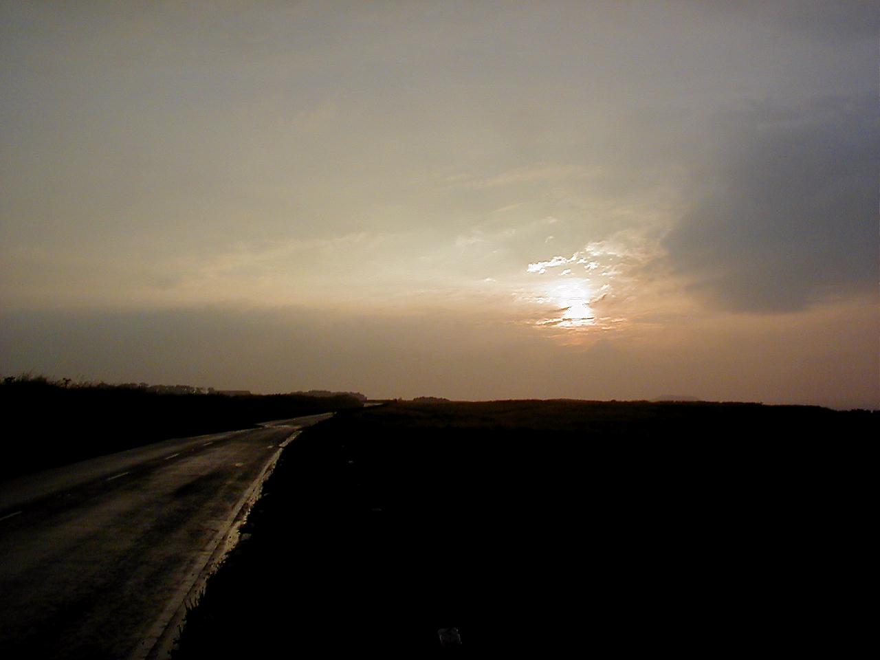
| Sunset, near Tantallon (56Kb) Another random drive around the Edinburgh outskirts. |
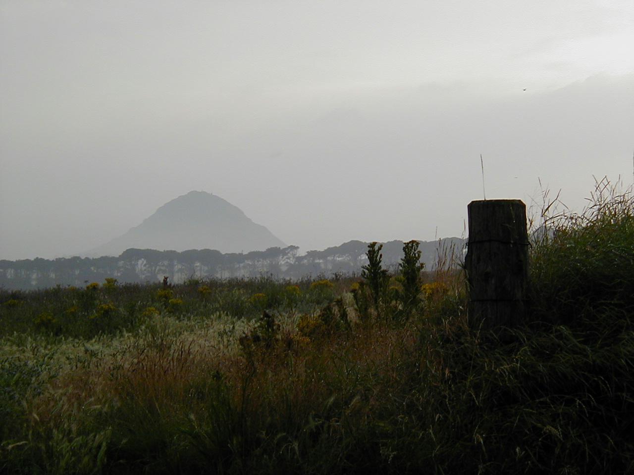
| Mist scene, near Tantallon (97Kb) Scotch mist, in it's natural environment. |
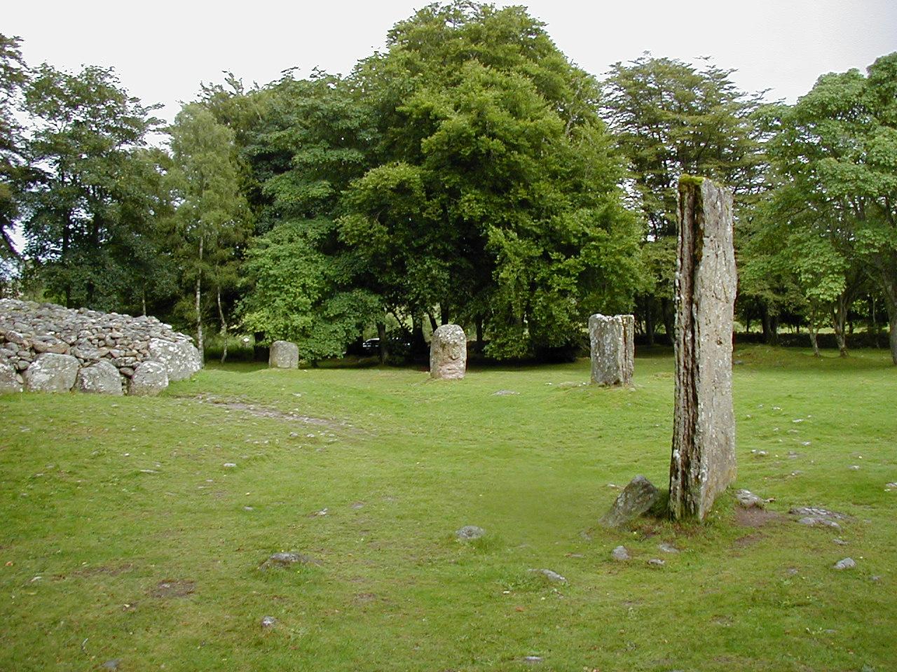
| Clava Cairns (286Kb) This is near Inverness, and is a group of three burial cairns, surrounded by standing stones. Built around 4000BC, but plus or minus a bit as dating a cairn is tricky at the best of times. In true British fashion, the road actually cuts through one of the circles with one of the standing stones from that circle doing service as a gatepost. For reference, the timing is around, or possibly slightly earlier than, the time the pyramids were built. |
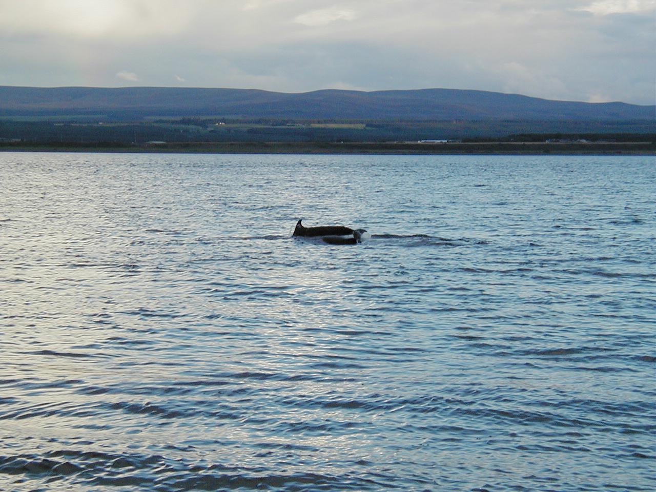
| Chanonry Point, Black Isle, near Inverness (196Kb) Dolphin spotting. This was a complete bonus, we just came down here to see if the lighthouse might be scenic. |
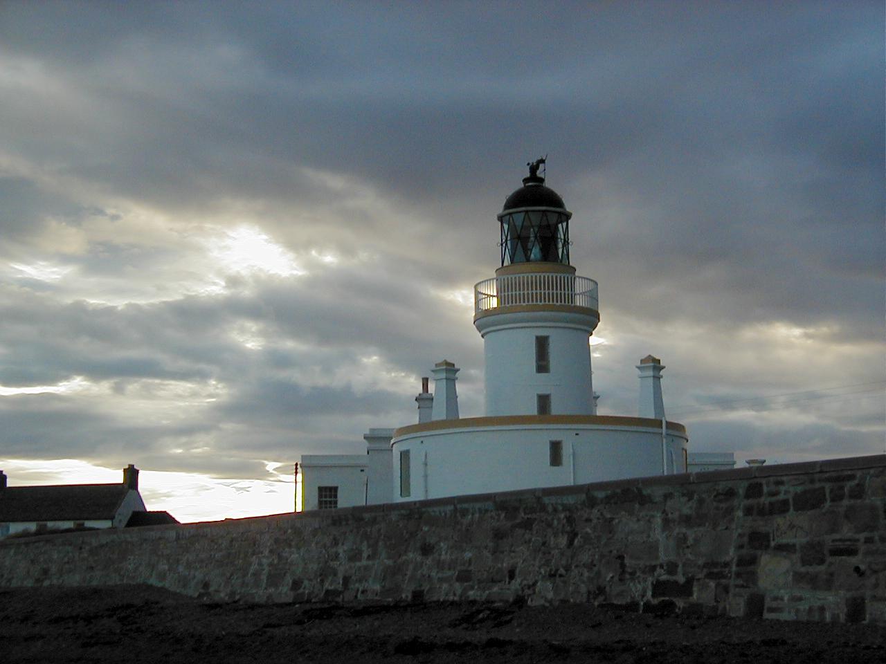
| Chanonry Point lighthouse (100Kb) Turned out that the lighthouse was rather scenic after all. |
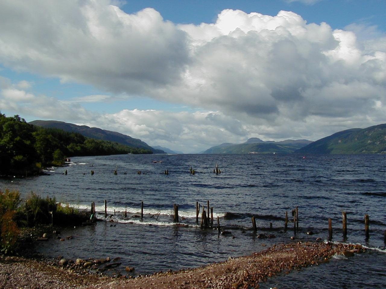
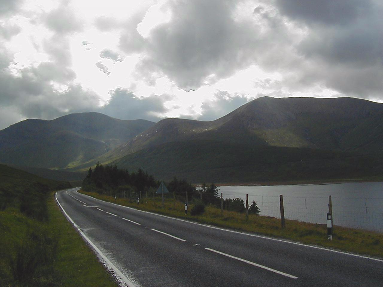
| Loch Ness, seen from Dores village (158Kb) This is looking down the length of the lake, from the north end. |
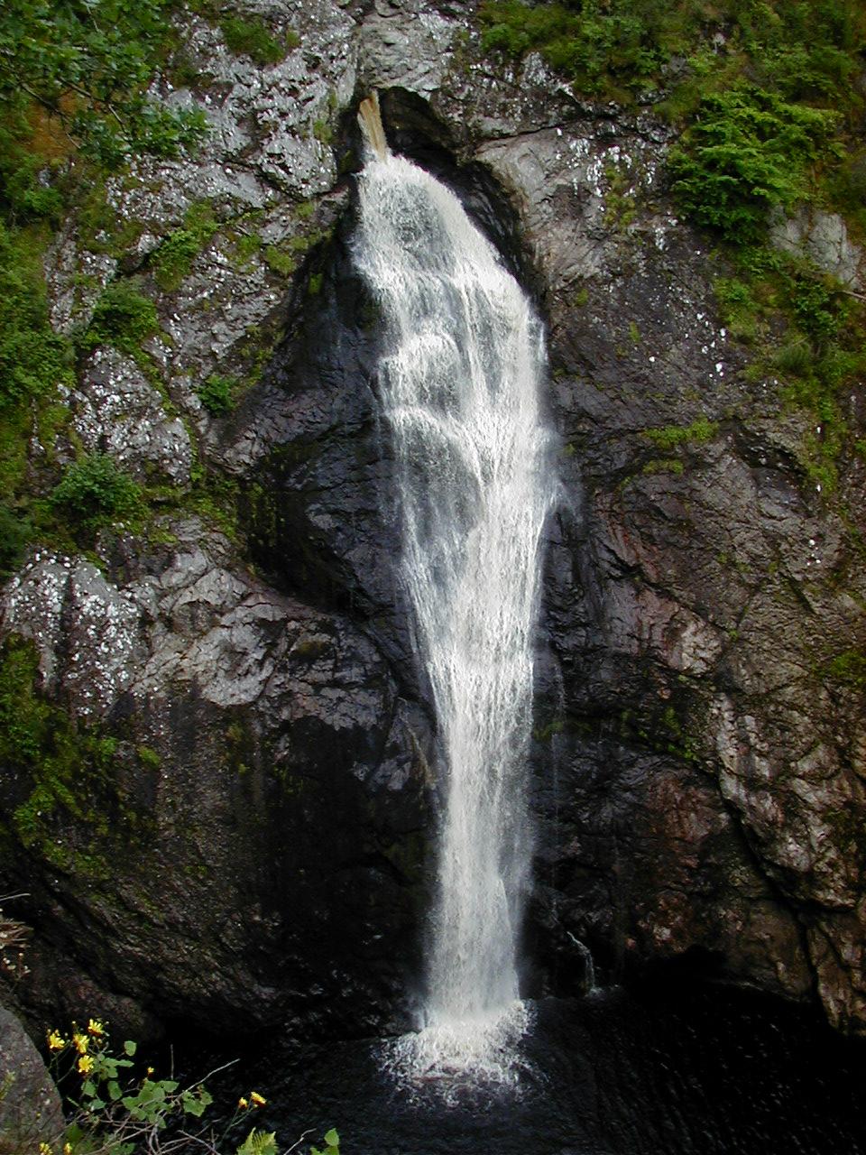
| Foyers Falls, Loch Ness (268Kb) A nice little waterfall, running into the Loch. |
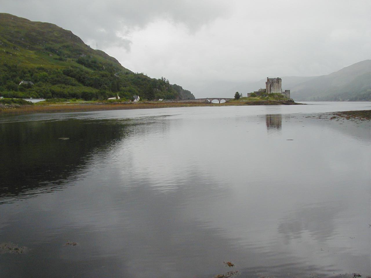
| Eilean Donan Castle, near Kyle of Lochalsh.(83Kb) About as scottish as a castle can get. This is a low tide shot (it's in Loch Duich, which is a sea loch) - normally the water would go all the way under the bridge. |
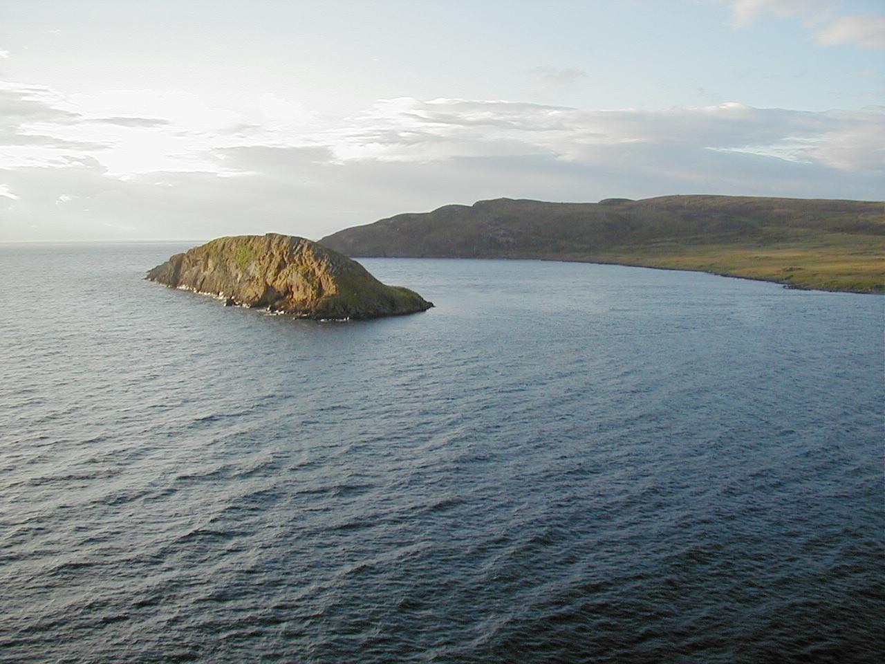
| Duntulm Bay, Isle of Skye (160Kb) Looking down from the headland with Duntulm Castle on it. |
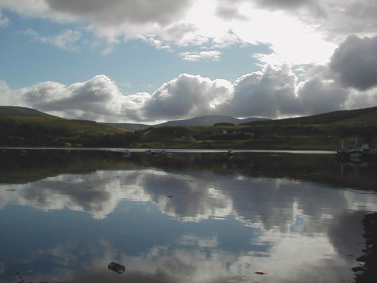
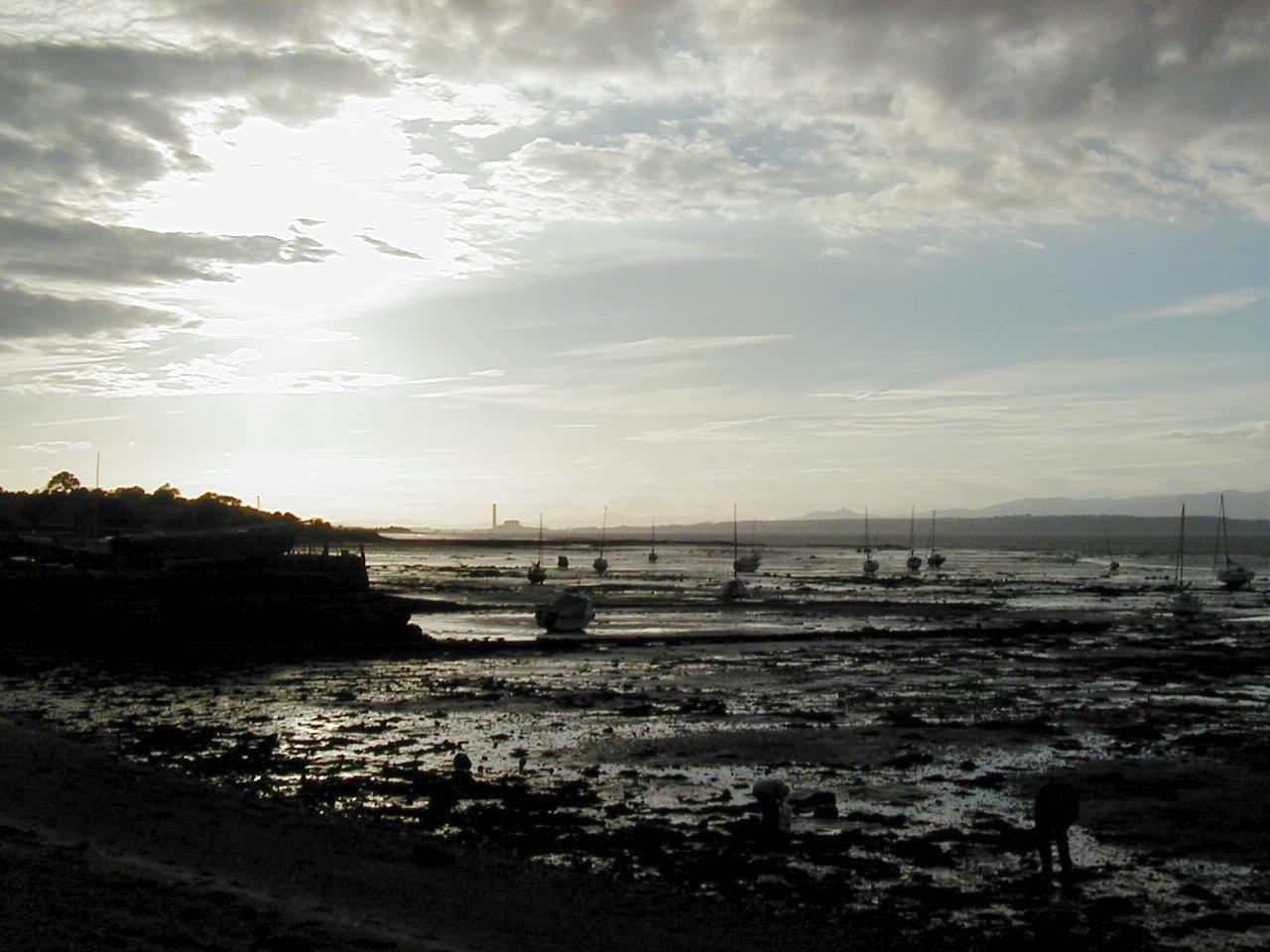
| Uig Harbour in the morning, Isle of Skye. (95Kb) You really wouldn't think that that piece of water is basically the atlantic ocean under a different name . . . |
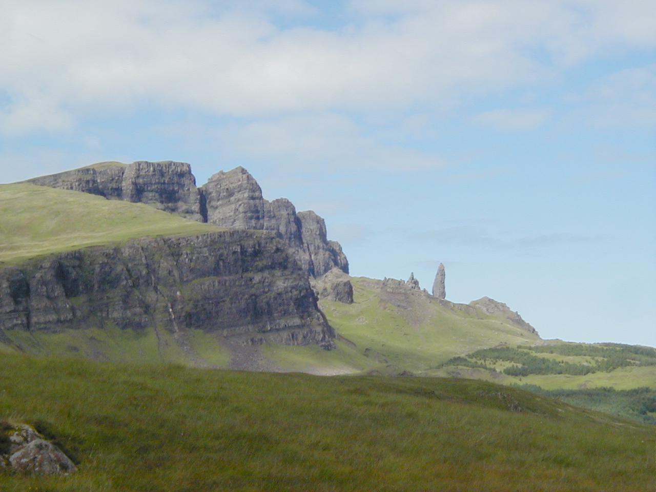
| Trotternish ridge, Isle of Skye (93Kb) The main geographical feature on the northern end of Skye. The single rock sticking up is a freestanding piece that fell off the main rock face at some point in the past. It's called the Old Man of Storr, and people go climbing on it. Rather them than me. |
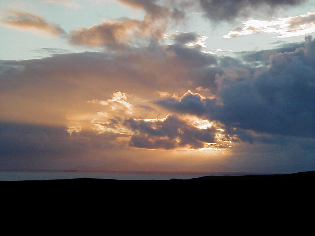
| Sunset, Isle of Skye (79Kb) One of many shots taken that evening |
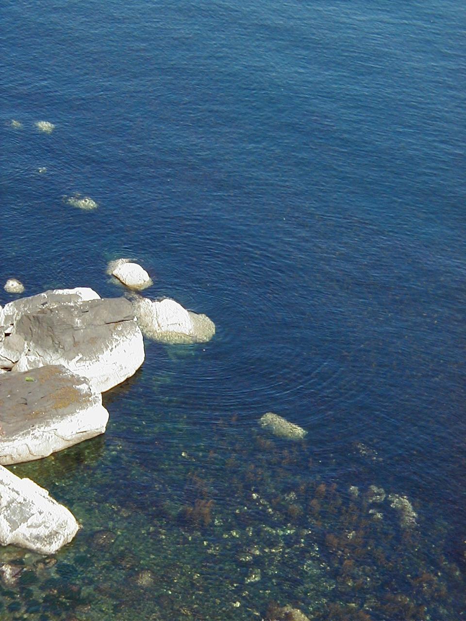
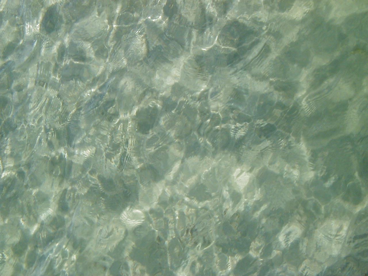
| Ripples, Isle of Skye (195Kb) Taken near Kilt Rock. |
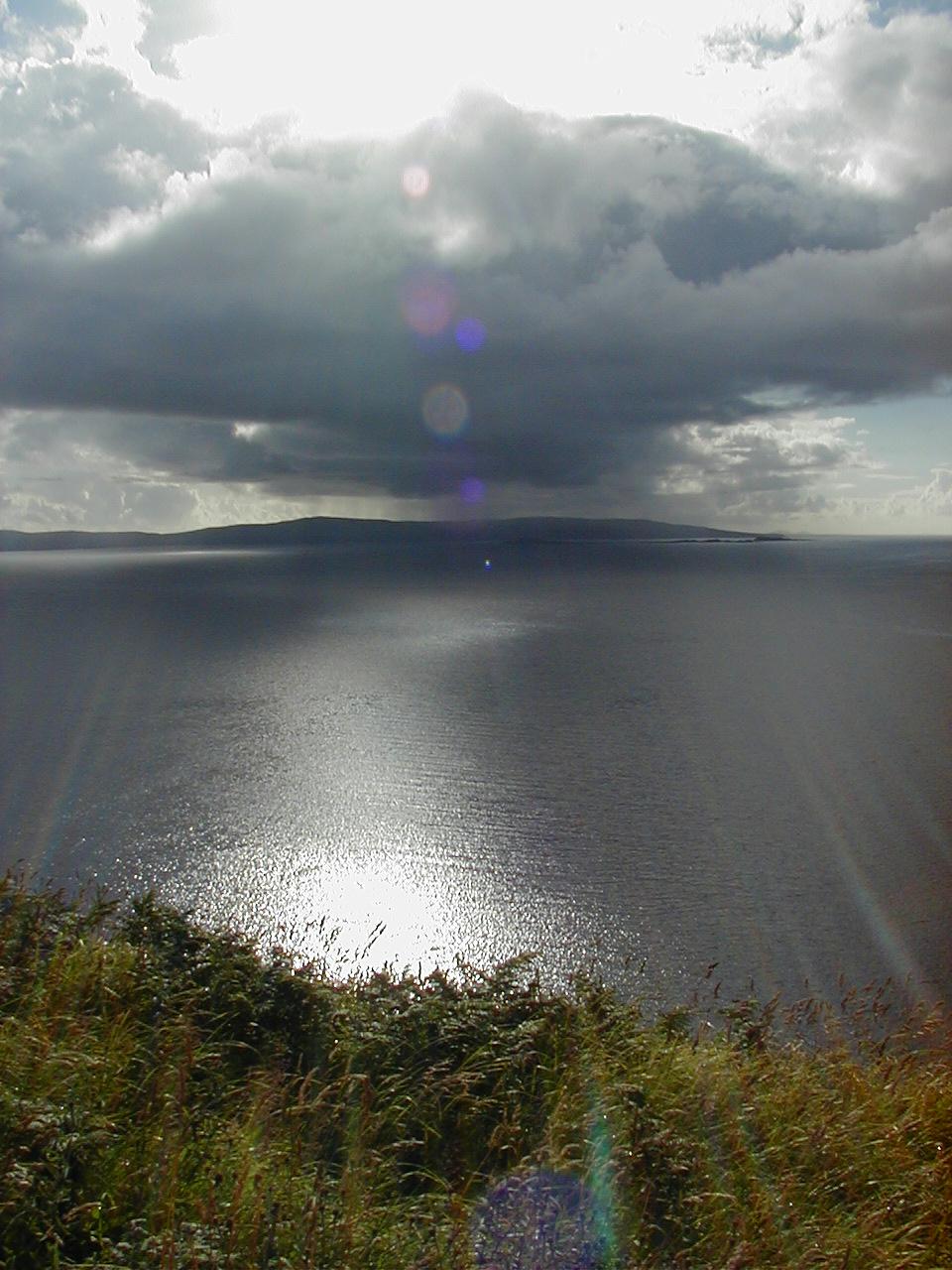
| Reflections, Isle of Skye (158Kb) An approaching storm, but what a view. That's either Harris or North Uist in the background I think. |
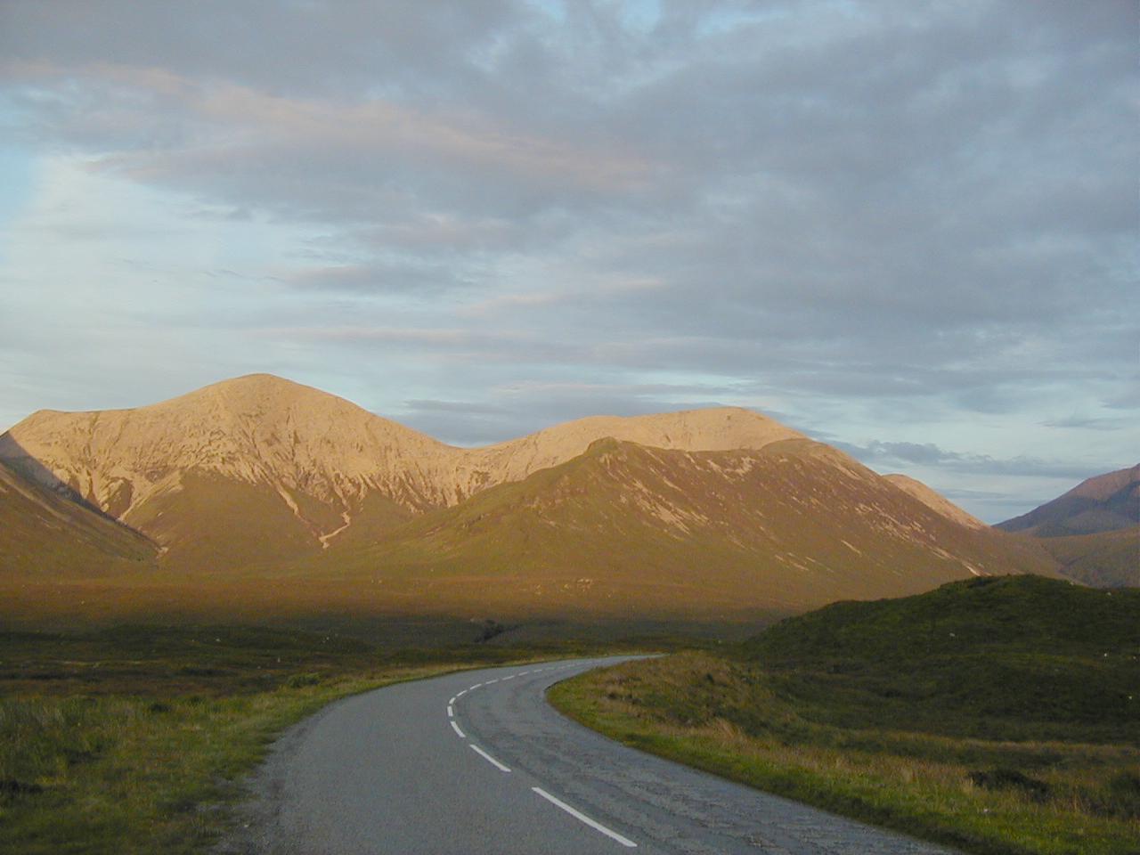
| Light on the Hills, Isle of Skye (99Kb) As the roadway indicates this was one of those views that just happened as we were driving along, and we just had to stop and take. Actually a lot of our time on Skye was taken up with burbling as some other spectacular item of scenery hove into view. |
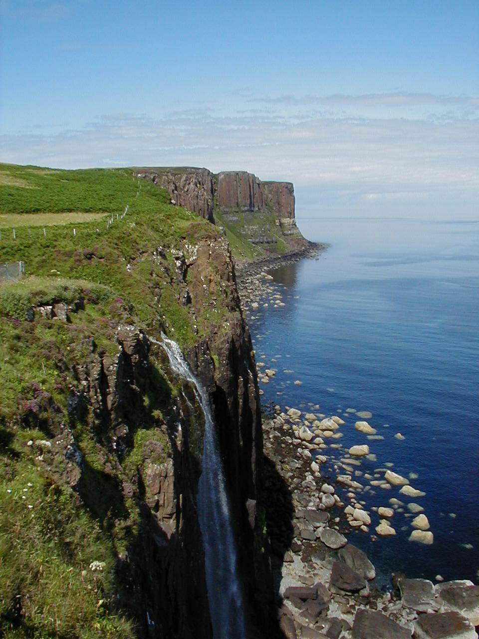
| Kilt Rock and Waterfall, Isle of Skye (165Kb) Called Kilt Rock because it looks like the pleating on a kilt, apparently. Also, a waterfall, draining directly into the sea, which is pretty rare I think. |
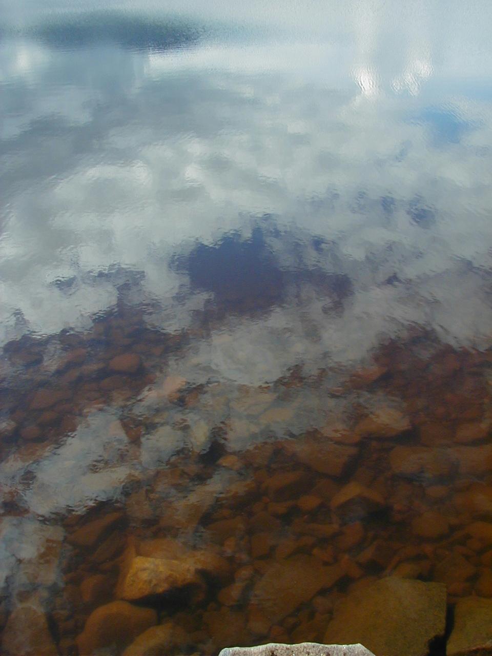
| Reflections, Isle of Skye (103Kb) Again, water flatter than a very flat thing. Did I mention that we got extremely lucky with the weather? |
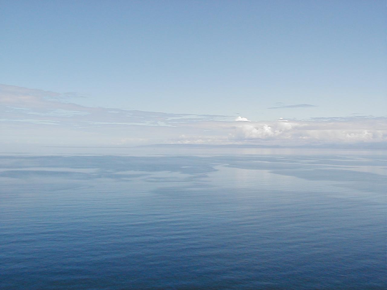
| Horizon, Isle of Skye(76Kb) Erm. Well, there's the sea, you see, and there's the sky, and somewhere in the middle, there's a join, but it isn't exactly clear where . . . |
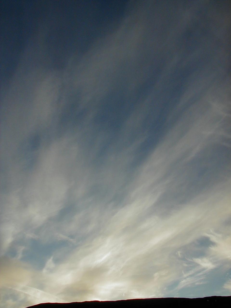
| Clouds, Isle of Skye (61Kb) Not scenery as such, just an impressively large sky. (Interestingly, the weather really isn't supposed to be like this - Skye is derived from the Norse name for cloud, which may also tell us something about where the Norse came from). |
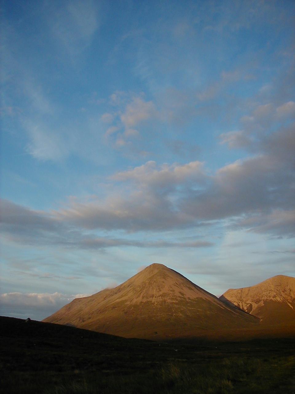
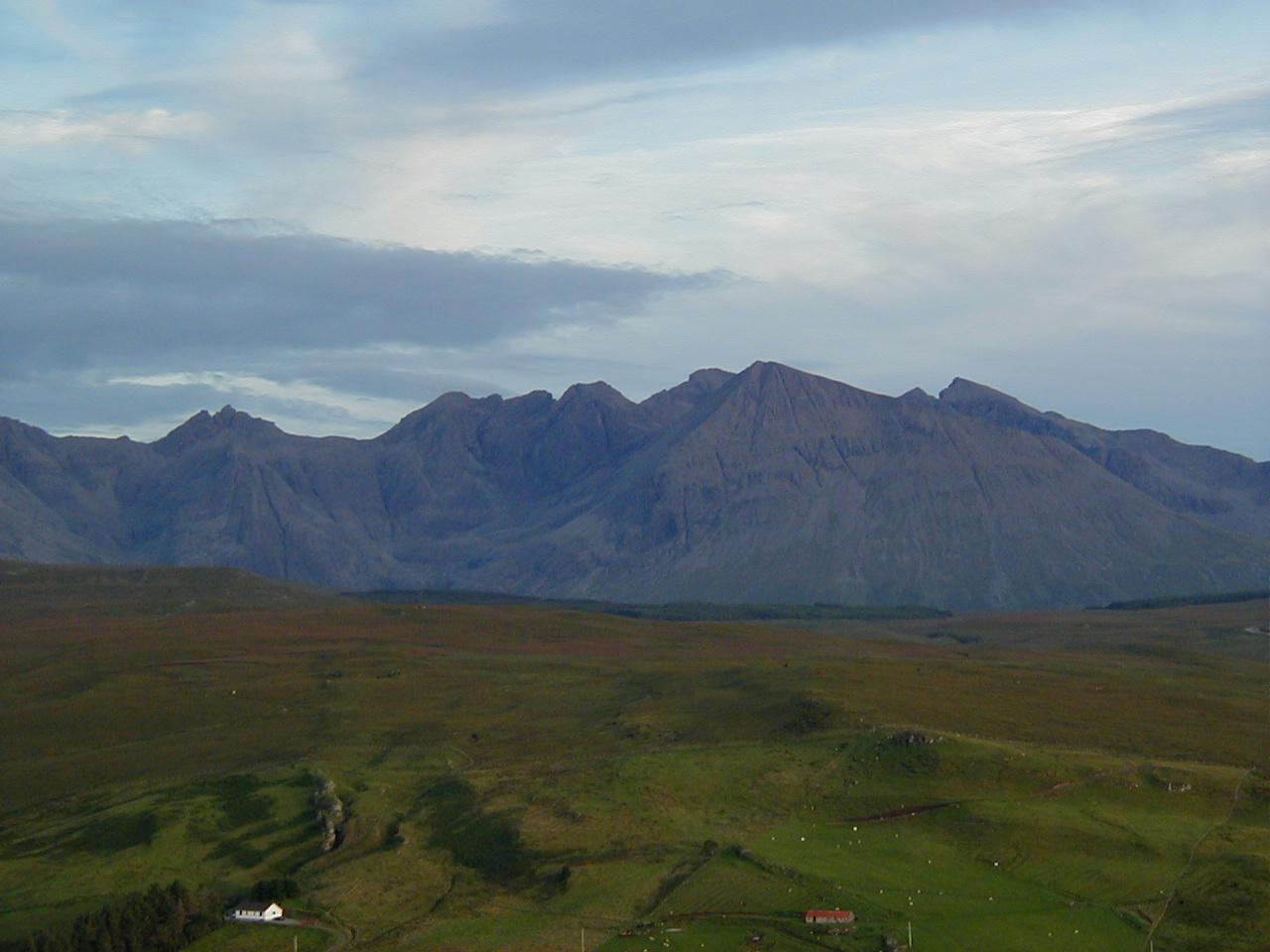
| The Red Cuillin Mountains, Isle Of Skye (95Kb) I think that's just stone and gravel on the top, not snow. |
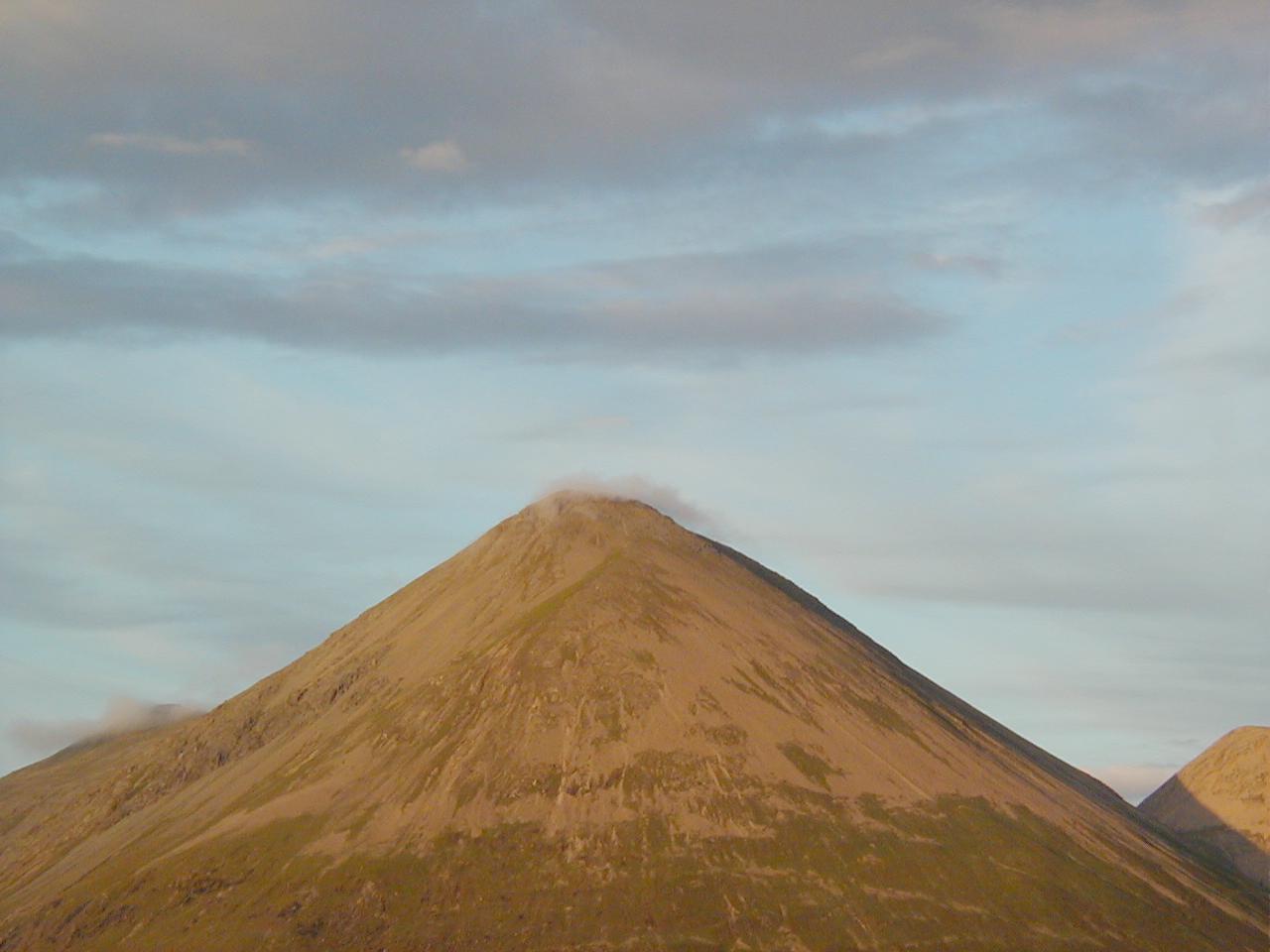
| The Red Cuillin Mountains, Isle Of Skye (76Kb) More breathtaking scenery. It's really dangerous to drive around here - you've got views like this, and the possibilty of sheep in the middle of the road on the next turn round your (often single track) road. That's cloud forming on the peak by the way, not a passing cloud that happened to hit it. You could just stand there and watch them form and evaporate as they moved away from the tip. |
| The Red Cuillin Mountains, Isle Of Skye (71Kb) Again, more impressively large sky. |
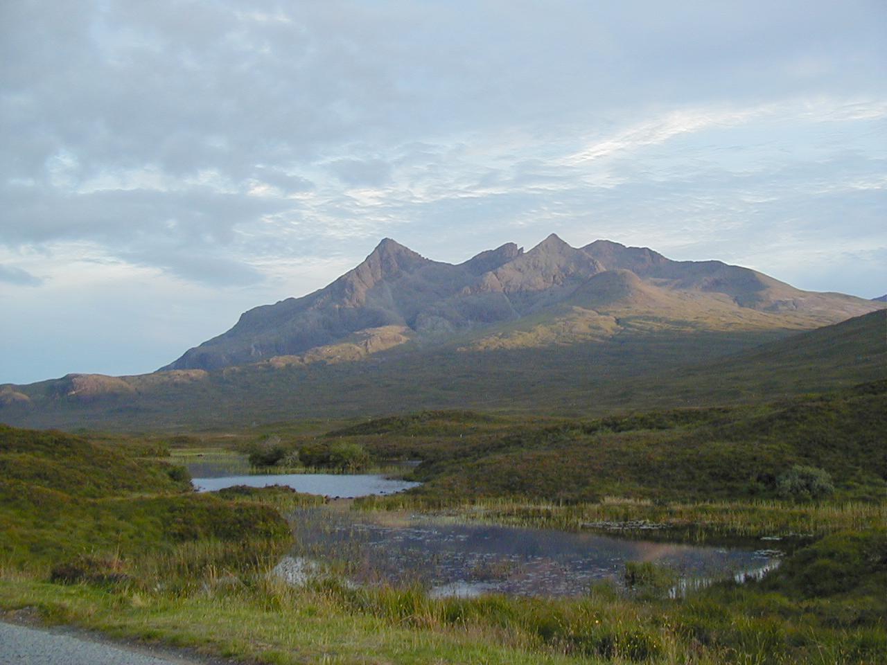
| The Black Cuillin, Isle of Skye (122Kb) The main part of the group of mountains known collectively as The Cuillin. This is higher than the red cuillin (which is why I don't think it was snow on the other peaks - there's none here). Like the trotternish ridge, this is high enough to be seen from most of the rest of the island unless there happens to be some more scenery in the way. |
| The Black Cuillin, Isle of Skye (90Kb) A slightly closer view. This thing dominates the horizon, and for those who are familiar with the book, is the closest thing I've seen to the mountain range that is supposed to surround Mordor (Lord of the Rings). |
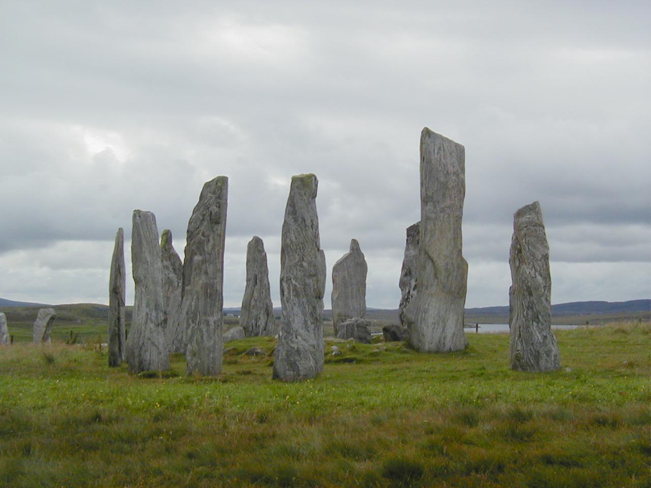
| Calanais Stone Circle, Isle of Lewis (107Kb) The central circle of stones at Calanais (Callanish). The rock here is wonderfully grained, partly because it's just that kind of rock, and partly because being buried in peat for a while emphasises this (peat being rather acid). |
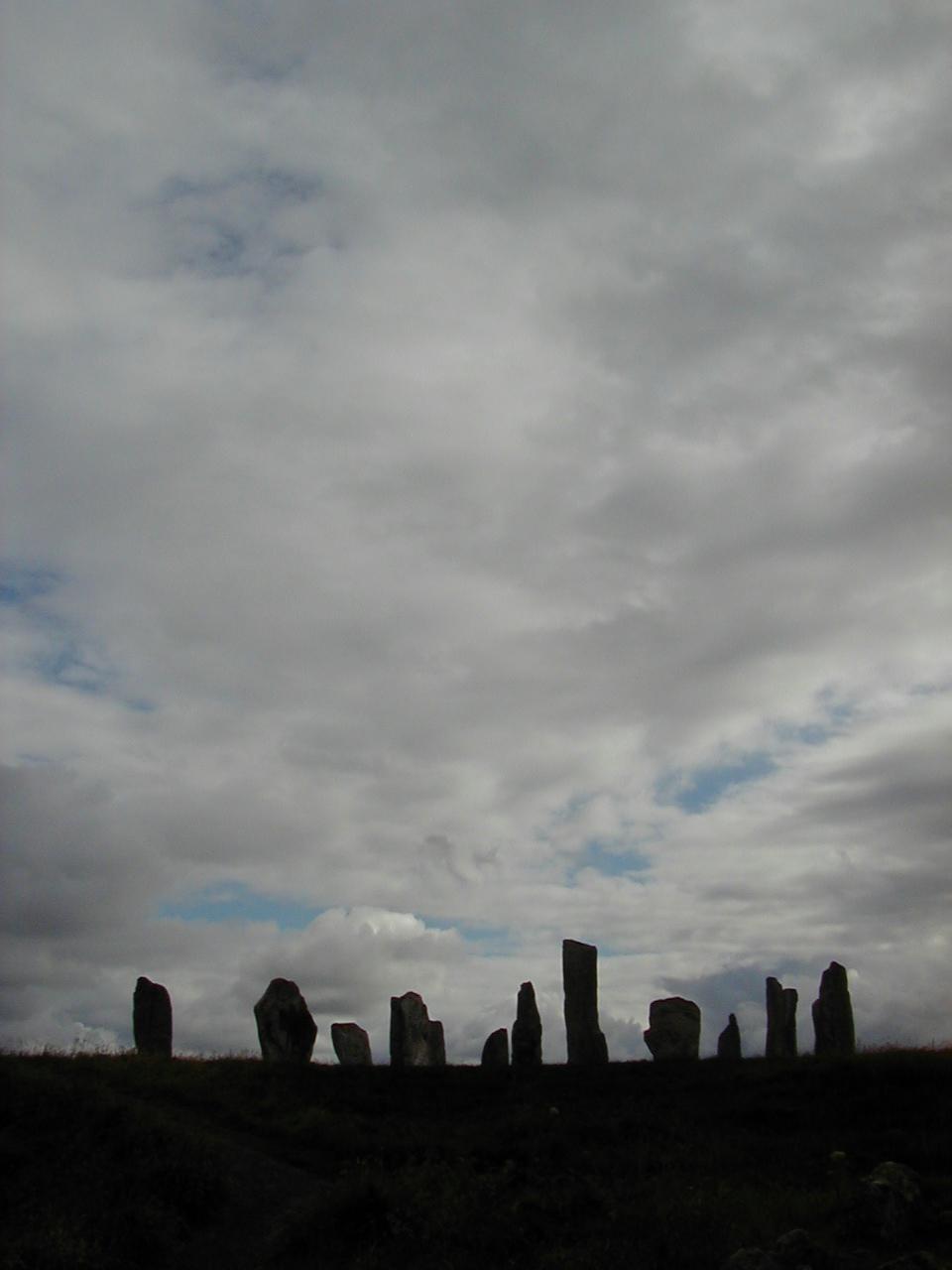
| Calanais Stone Circle, Isle of Lewis (54Kb) In silhouette. |
| The Atlantic Ocean, Isle of Harris (128Kb) Just look at that green. I could have claimed to have gone to Bermuda or somewhere Caribbean . . . (Incidentally, for those that don't know the geography, Harris and Lewis are actually the south and north ends of the same physical island. It's a long story. Oh, and Skye is actually connected to the Scottish mainland with a bridge now, so you don't need to take a ferry to get there). |
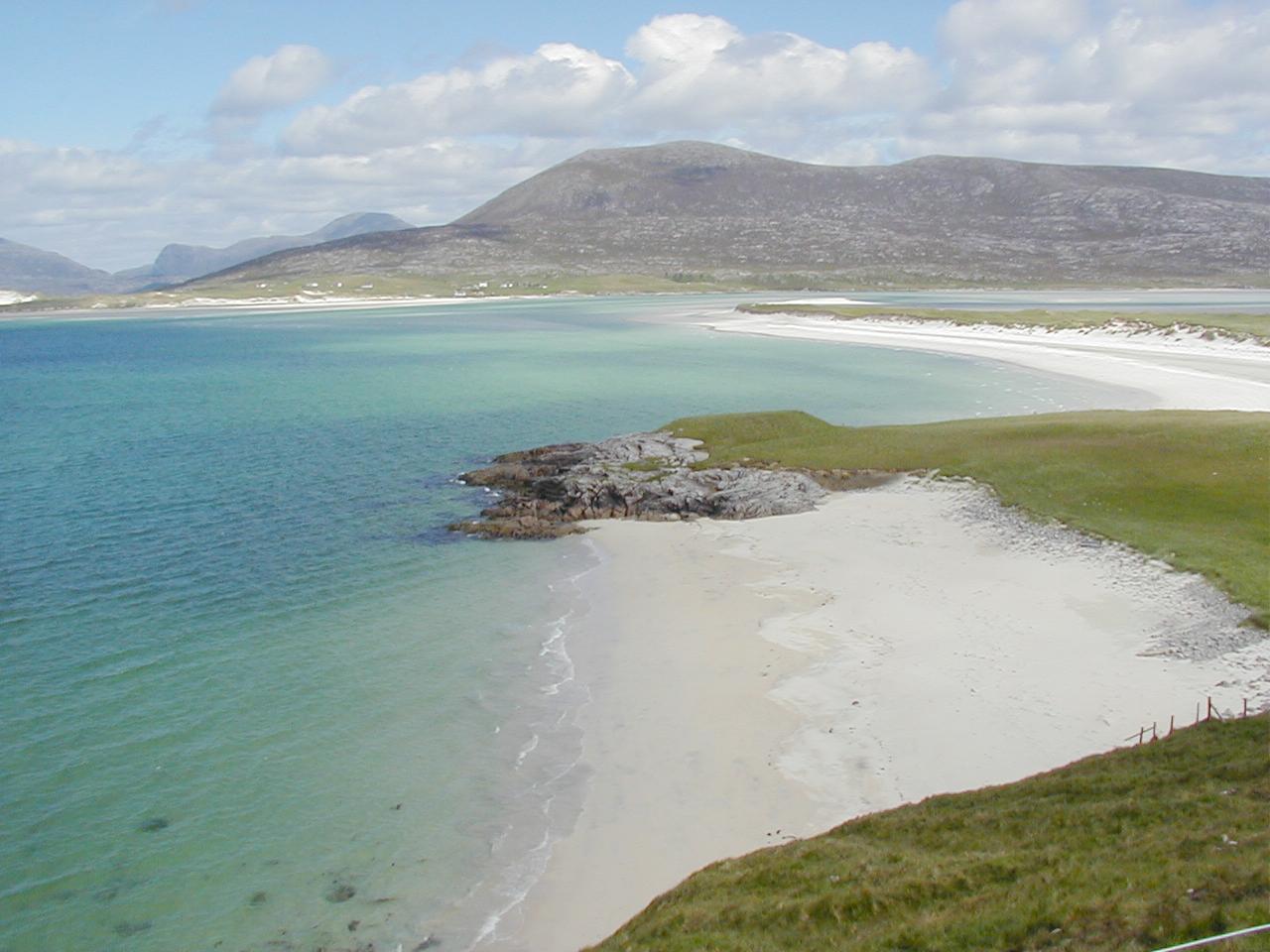
| Beach, Isle of Harris (121Kb) Again, Bermuda anyone? It works, except for the completely barren mountainside behind it . . . |
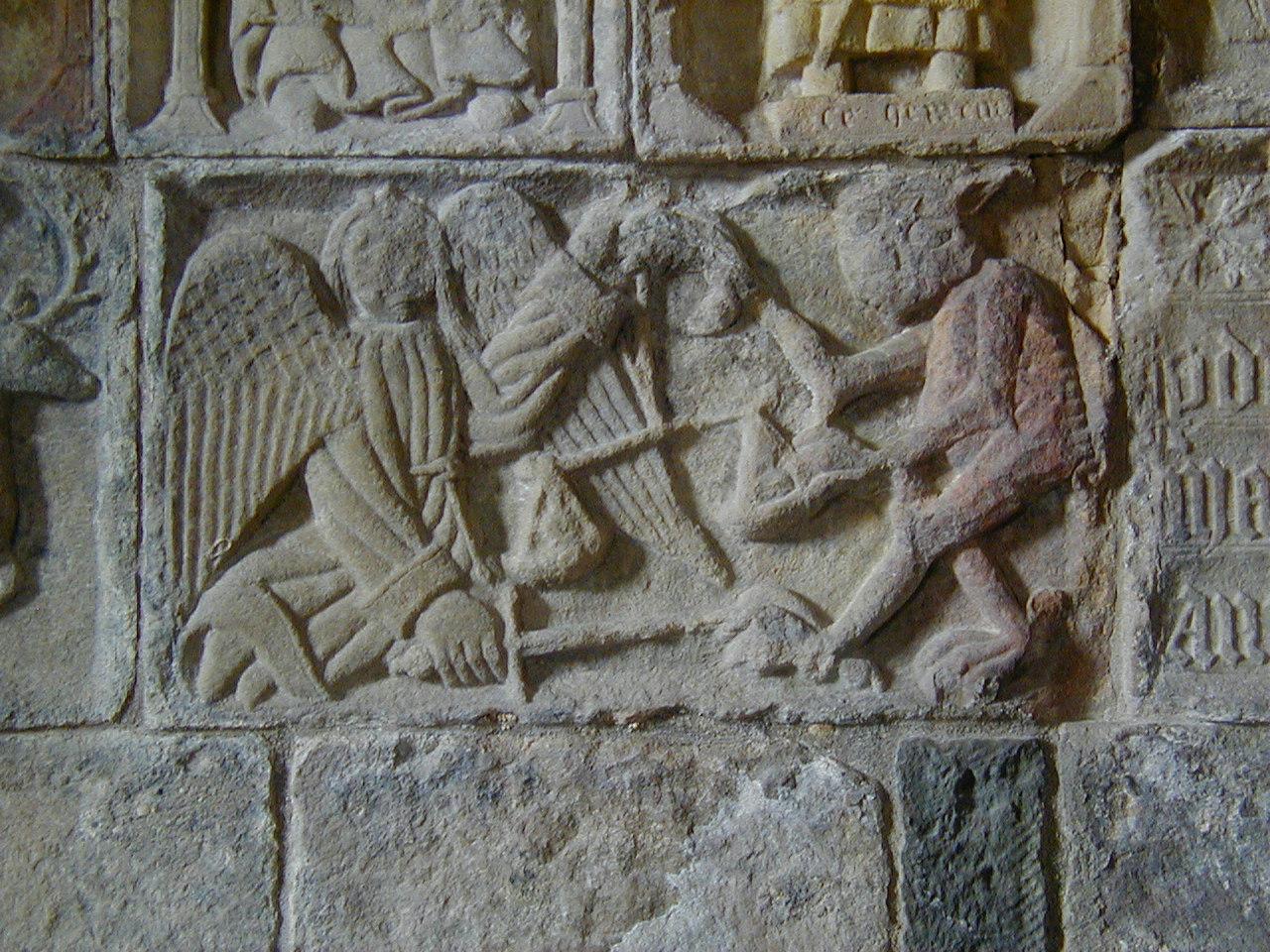
| Carving, Saint Clement's Church, Rodal, Isle of Harris (288Kb) In a little church at the southernmost tip of Harris, are some carvings dating from around the 1520's or thereabouts. Pretty old in other words. There just there for you to walk up to an take pictures of. This is the devil and an angel weighing souls (note the scales, and the fact that the angel has a sword). |
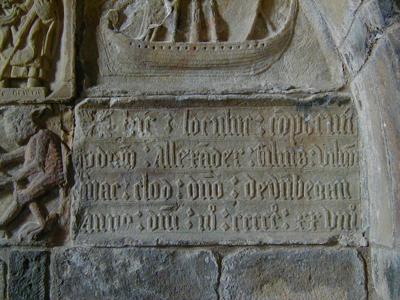
| Carving, Saint Clement's Church, Rodal, Isle of Harris (292Kb) Another panel from the same group. It's latin, but the bottom line reads: "Anno Domini, MCCCCCLLVIII", which, allowing for ignorance of the D Roman numeral, works out to be 1528. This, and the above, are from the tomb of Alexander MacLeod (or Mac Clod as is appears on the panel). This is all very well, except for the small detail that he isn't actually in it. |
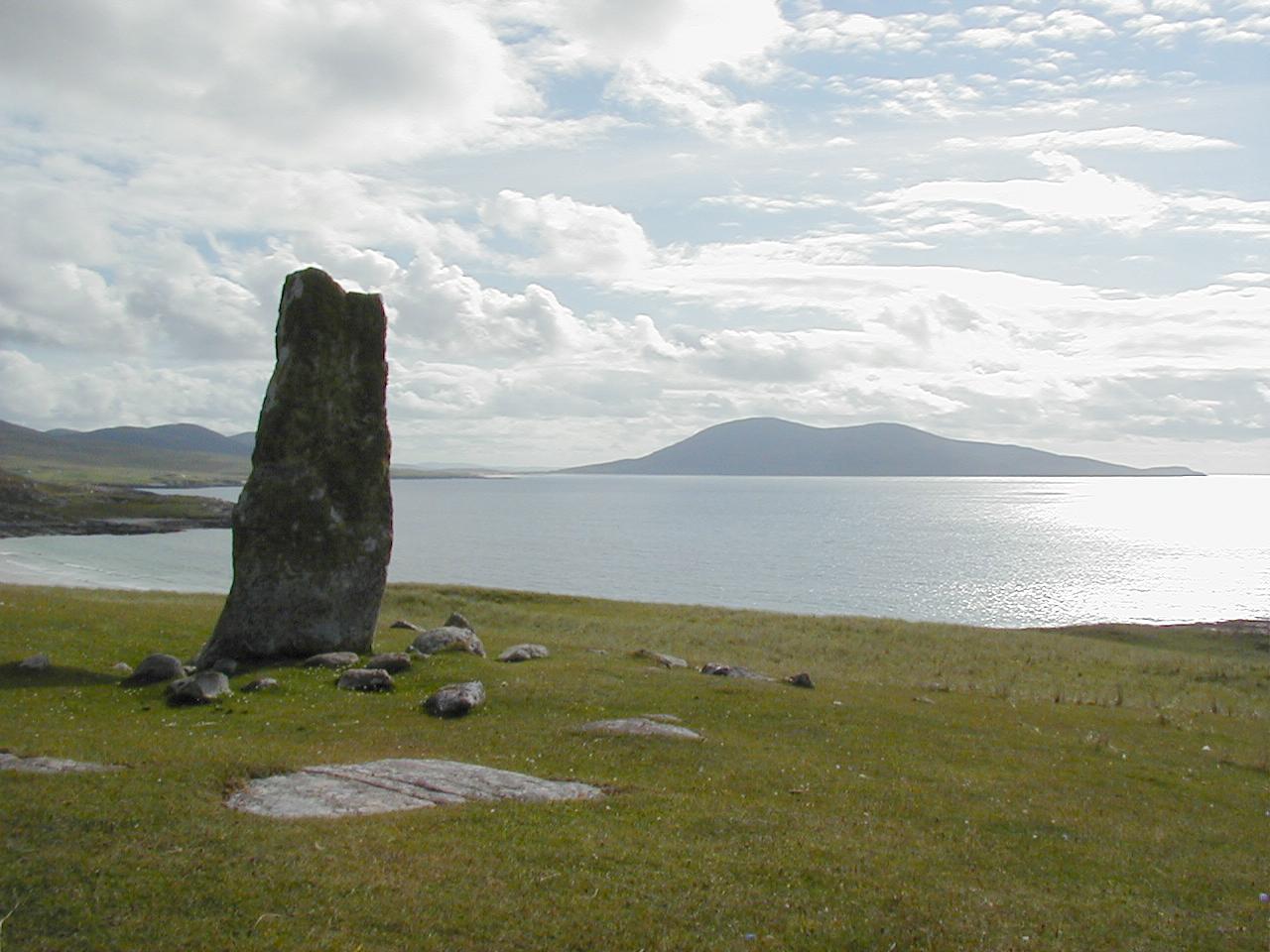
| The MacLeod Standing Stone, Isle of Harris (132Kb) A better desciption might be the MacLeod Leaning stone. It looks worse than this from some angles. |
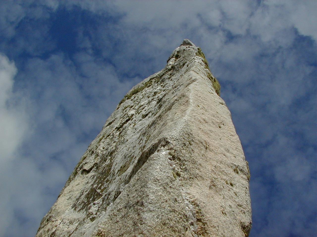
| The MacLeod Standing Stone, Isle of Harris (154Kb) A fun shot . . . |
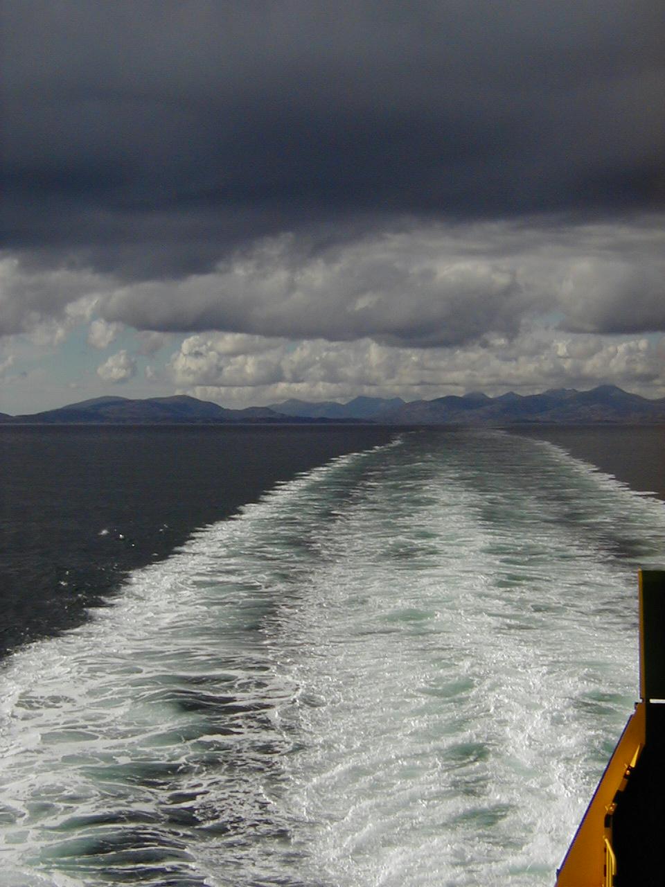
| Tarbert, Isle of Harris (143Kb) Seen from the ferry back to Skye . . . |
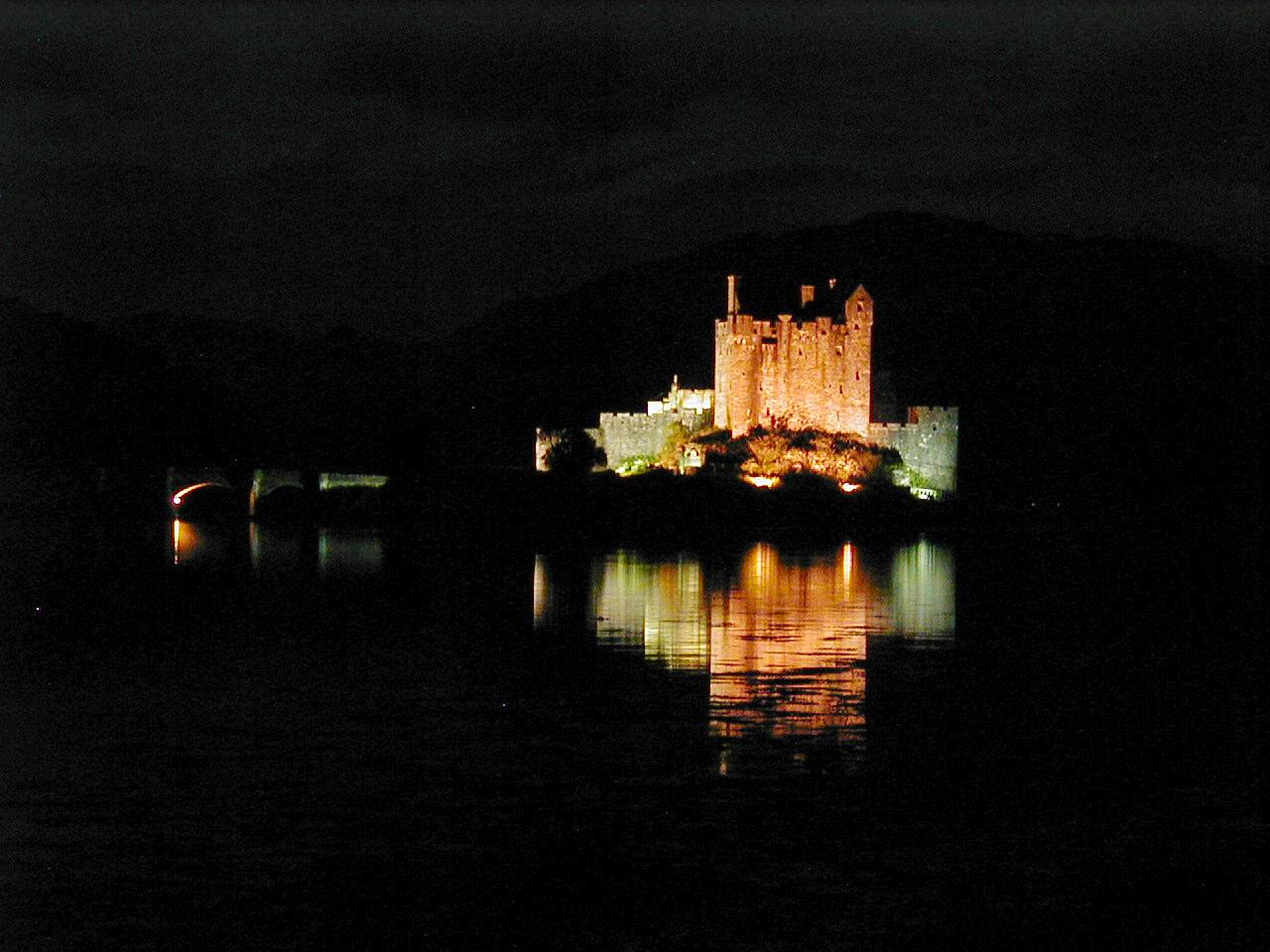
| Eilean Donan Castle, near Kyle of Lochalsh. (151Kb) Another gasp from driver and passenger as we turn a corner on the way back and find out that they have mood lighting on it at night . . . there were a whole bunch of other people there at the only sensible parking point, with big cameras on tripods, taking 2 second exposures of the thing. This one (the only one without camera shake) was taken by standing the camera on the ground near the edge of the loch. |
|
|
|